Flyttracker
flytTRACK offers a powerful cloud / private server-based software solution developed according to the current aviation regulations and your flight department’s requirement in mind. Though customizable, the software by itself meets several advanced features making it the only aircraft tracking solution an operator will need.
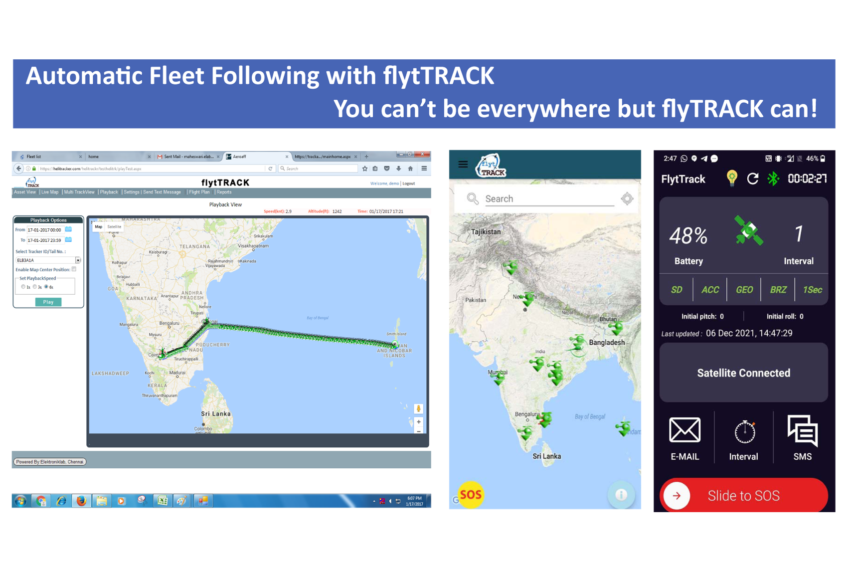
flytTRACK web portal is user friendly and puts flight information at the palm of the flight manager. flytTRACK is also a great tool for SAR operations. Based on the last known position the SAR module modelled on IAMSAR will generate the required search pattern area. With advance features like built-in accelerometer& inclinometer, the operator will be able to meet all GADSS requirements
What is GADSS?
ICAO (International Civil Aviation Organization) launched the Global Aeronautical Distress Safety System (GADSS) largely in response to the loss of flights AF447 and MH370. GADSS contains Standards and Recommended Practices (SARPs) that establish what is expected of airlines and aircraft operators for tracking aircraft in normal conditions as well as when an aircraft is in distress.
Operators are expected to receive positions at least once every 15 minutes during the normal conditions of flying. In case of any distress, operators will be able to track their aircrafts and helicopters automatically at least once per minute. The SARPs relating to the location of an aircraft in distress came into effect in January 2021.
Sailent Features
- GADSS Compliant
- Cloud or Private Server based options
- AFF (Automated Flight Following) features
- Automated Distress Tracking
- Situational awareness for crew & operators
- Built In asset information management
- Effective flight planning & logistics management tools
- Track your fleet on a Map view with different map options
- Lists target update with date & time.
- Identifies targets as
- Active / Sleeping / Lost
- Alert settings for change in altitude, heading, waypoints
- Dedicated app based SOS- Short burst 2 way messaging, SMS & Email
- SOS alert at device end, web portal and user app
- Pitch, Roll & Speed alert- Breaching, Geo-Fence & SOS alerts sent by Email / SMS
- Geo-Fencing can be set for Circular / rectangular area
- All alerts continued until acknowledged- Static & Dynamic markers can be created with ID.
- History of flight record can be retrieved for playback
- Export route to Google Earth / Excel format for analysis
- NOTAM & METAR weather data
- Alerting Method Beep sound in the PC & SMS / Email
- Last known position sent as map link.
- Reports:
Hardware Specifications
- Dimensions (175 x 130 x 45) mm
- Weight 750 gms
- Time tested Inmarsat satellite network
- Hand portable unit (no installation)
- Integrated 56 channel GPS
- Unit Environmentally
- sealed IP 67
- Typical Latency: <10 sec,
- Elevation Angle: 15° to +90°
- 2 way communication available
- E-Mail / SMS
- GPS/GLONASS Acquisition Time: Hot: 1s; Cold: 29s/30s
- Operating Temp: -20°C to +85°C
- Max speed useable upto 1800 km/hr
- Max altitude upto 49,900ft- Inbuilt Battery 7.4V, 5Ah
- Inbuilt Panic button
- Inbuilt BLE for communication
- Inbuilt accelerometer
- Meets tracking requirements of many government CAR, UN, Red Cross etc...
- Environmental: Water & Dust ingress protection - IP67
- Operating Temperature -10o C to + 55o C
- Humidity - 95% @ 40o C
- Drop - Survives at 1 meter drop